The Thinker Segment
In the "historic" hike guides, the Thinker is mentioned, as is the Poe statue. The former was outside of the Baltimore Museum of Art until 1971, while the latter was across the street in Wyman Park until it was moved to the University of Baltimore campus. The hike route, by coincidence, travels past the new home of Poe, and the Thinker being inside only prevents it being seen as easily as before. It's also prohibited to reproduce photos taken inside the museum, so the image below links from WikiMedia.

My hike plan was easier to begin than the previous 3, because the Metro subway has just 2 stops between Mondawmin and State Center. The historic route went from the Key statue on Eutaw Street to the Baltimore Zoo. Retracing those steps seemed pretty simple, once I parked my car at the zoo lot. Recently, the Sunpapers had a story about street signs, mentioning the longest name is "Auchentoroly Terrace". And there it is (but Terrace is abbreviated...).

The first leg of the hike started either at the Key statue, or the Lillie Carroll Jackson Museum, 1320 Eutaw Place.
The (former) Jackson Museum site.

In the same vicinity...
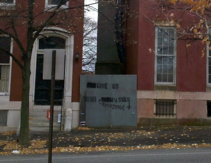
Traveling east on Lanvale, per the hike guide.

Sometime in the early 1970s (or late 1960s), the house on Lanvale Street were rebuilt, and the street blocked from entrance on Eutaw Street.
I went past MICA (Maryland Institute College of Art; strangely, not mentioned in the historic guide), and then found the next monument listed - the Maryland Line statue. It's across from the old B&O railroad station, taken over by MICA in the 1960s.

The old hike guide asks what the Maryland Line referred to, and when the battle of Brandywine was fought. No hints here.
Then, past the Lyric Opera House, which is growing again, it seems, stopping by the Poe statue.

At this point, the hike guide book goes a bit vague, suggesting that the next important historic building is way up on 22nd Street and St. Paul, ignoring the University of Baltimore, the Pennsylvania Railroad Station, and the historic City northern boundary (AKA, North Avenue).
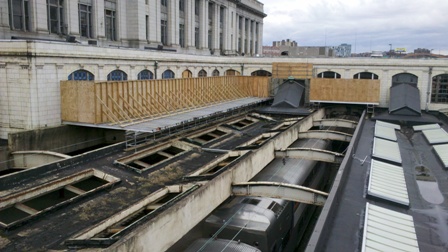
The back side of Penn Station (there are plenty of pictures of the front...)
I took photos of several churches around North Avenue and St. Paul Street, or Calvert Street. It seems there are at least one per block. I recall visiting Seventh Baptist Church, which still looks open, if not thriving.
Oh, and King and Kennedy Park. I strolled by, but there are no historic markers, at least on the main site. I didn't look closely at the eastern edge, which contains a fenced-off playground space.

After that stop (I'd been inside for a good friend's wedding, in a prior century), I took the parallel route of Calvert Street, shooting photos of a few boarded up houses along side those with decent looking domiciles.


After the Penn Station area, it was up to the Charles Village haunts of my undergraduate era. I'll skip the "when I was there" stories, and jump straight to the Baltimore Museum of Art, or the focal destination of the Thinker Segment.
I observed the Thinker statue, by Rodin, and a few other BMA gems, including trophies from the 1935 Kentucky Derby, the Belmont Stakes, and the Triple Crown itself. Why the Preakness Cup for that year was not on display is a mystery.
If you do this hike, and the Museum is closed, go to the north side of the building and walk around the outside sculpture gallery. It will be more interesting than continuing to walk on Wyman Park Drive. Then, keep going around the lane between the Museum and the Hopkins campus (another curious omission from the earlier hike guide). Take a look at this sculpture:

Unfortunately, vandals have removed the inscription from a Hopkins class (I believe it was 1970, since I saw it on the north end of what was then the lower quadrangle in the early 1970s). It's a shame that it was banished from a prominent location; but perhaps it was intended to be an elevation, taking it closer to "real" art in the Museum, and sculpture valley. Who knows?
The old hike guide asks questions about statues in the park. Here's a hint - one is for the Union, and the other one isn't. The Poe statue, if it were still there, would have predated the conflict. Or, his life did; maybe not the statue.
Instead of sticking to Wyman Park Drive, I wandered behind the old School of Public Health, which now seems to be crawling with Johns Hopkins outposts, though it did appear to still maintain some aspect of public-facing service.
Tin Men
OK, they weren't putting up aluminum siding, but it's pretty close.

Lastly, after passing the Scout building, and crossing the Jones Falls, as well the Expressway it's named after, I walked around the north side of Druid Lake.

I thought it was pretty cool that there was a working water fountain, right next to the largest water supply reservoir in the city limits (the reservoirs in the county are owned by the city, but they are in the county).
The Columbus monument:

When I was young, this memorial was placed in Herring Run Park, by Harford Road and Argonne Drive. I wondered where it had gone to, as I noticed decades ago that it wasn't where it had been originally. On close inspection, part of the dedication has been vandalized.

So there is one last lake:

Per an old map I have (published 1957), the lake is known, or was known, as Boat Lake. I wonder how long it's been since people rowed on it?

The links on the photo (before the map) will show this shot is on the north side. The latest Google maps show there are paths around both sides of the lake that will take you to the Zoo parking lot on the west side. However, it turns out there are fences that block the north paths. So I had to reroute.
Edge of the fence.

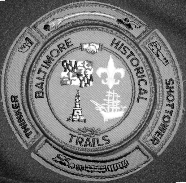
Patch with all 4 segments
Below are the links to photos on Panoramio, tagged with "BaltHistTrail4".

No comments:
Post a Comment